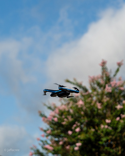
HOUSTON, TX -- As organizations seek faster surveys, improved safety, and more accurate data, CHR Solutions, a provider of engineering, cybersecurity and software solutions for communications service providers (CSP), is meeting this growing demand with the launch of its enhanced drone-based data collection program.
Drone adoption in the infrastructure and construction sectors is accelerating rapidly, with industry research showing that nearly 60 percent of U.S. construction firms now use drones in their field workflows in 2024–2025.
“Drones give us the ability to gather precise field intelligence faster and more safely than traditional methods,” said Bob Bartz, Executive Vice President of Engineering Services at CHR. “With BEAD-funded builds, new fiber routes, and the explosive growth of AI-driven data centers, providers can’t afford delays caused by incomplete or inaccurate field data. This program positions CHR to help our clients move quickly from design to construction, reduce bottlenecks and keep pace with the scale and urgency of today’s infrastructure demands.”
The new program significantly expands CHR’s Engineering Services capabilities, enabling the company to deliver safer, more efficient, and highly precise field intelligence for broadband providers, utilities, construction firms, and emergency response organizations. Powered by CHR’s dedicated drone fleet, the offering includes:
· High-resolution site imagery
· Orthomosaics, and point clouds
· Detailed pole-condition assessments
· GIS-ready datasets.
Expanded Drone Services Offered by CHR
Aerial Site Surveys
CHR captures high-quality photos, orthomosaics, and point clouds to support construction planning, commercial development, and project monitoring—allowing clients to reduce on-site time and accelerate project schedules.
Visual Pole Surveys
Designed for broadband providers, utilities, and municipalities, CHR’s drone teams perform detailed pole inspections, documenting attachments, pole tags, and structural conditions. Each survey includes GPS-tagged imagery and a written condition assessment, with AI-based asset classification currently in development.
Emergency Response Support
In high-risk and disaster environments, CHR uses drones to provide live monitoring, damage documentation, and real-time situational awareness. The service supports emergency response teams, government agencies, and industrial operators who require fast, accurate field visibility.
Digitizing As-Builts Using Drone Imagery
For legacy providers with outdated documentation, CHR digitizes existing telecom routes—both aerial and buried—into modern GIS-based datasets using drone imagery and client as-builts. This improves accuracy and creates reliable foundations for future builds. |